Cartography Settings
The cartography settings allow you to customize how the map is rendered, and what is shown on it.
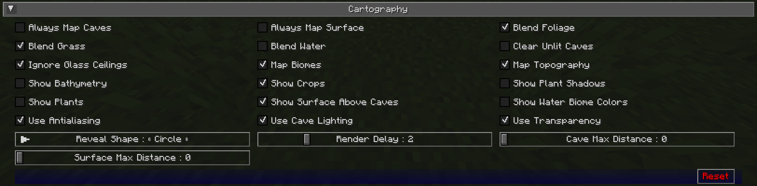
Toggles
The bold toggle settings below are enabled by default.
| Toggle | Description |
|---|---|
| Always Map Caves | Whether to map caves below you when you’re on the surface |
| Always Map Surface | Whether to map the surface above you when you’re in caves |
| Blend Foliage | Whether to apply biome colours to foliage |
| Blend Grass | Whether to apply biome colours to grass |
| Blend Water | Whether to apply biome colours to water |
| Clear Unlit Caves | Unlit and inner slice blocks are rendered clear instead of black. This option only effects newly mapped blocks. |
| Ignore Glass Ceilings | Whether to remain in surface mode when under a glass ceiling |
| Map Biomes | Whether to show biome colours on the map |
| Map Topography | Whether to generate a contour map that shows elevation |
| Show Bathymetry | Whether to show underwater terrain on the map |
| Show Crops | Whether to show crops on the map |
| Show Plant Shadows | Whether to plants and crops should cast shadows on the map |
| Show Plants | Whether to show plants on the map |
| Show Surface Above Caves | Whether to show a dimmed view of the surface when in cave mode |
| Show Water Biome Colours | Whether to show water colours based on biomes |
| Use Antialiasing | Whether to use anti-aliasing to improve the shading effect used to show elevation |
| Use Cave Lighting | Whether to show lights underground - disable for a fully bright map |
| Use Transparency | Whether transparent blocks should reveal what’s below them on the map |
Other Settings
The default option for each setting below is marked with bold text.
| Setting | Options | Description |
|---|---|---|
| Reveal Shape |
|
Whether to reveal chunks in a circle or square - circle reveals show fewer chunks at once, and so perform better |
| Render Delay | Range: 0 - 10 (in seconds, Default: 2) | How often JourneyMap should try to render the chunks around you - Higher values can result in better performance, but may result in chunks being missed when traveling at high speed |
| Cave Max Distance | Range: 0 - 32 (in chunks, Default: 0) | The maximum distance within which to attempt to render the map while in a cave - if you set this higher than your render distance, then this will use that instead |
| Surface Max Distance | Range: 0 - 32 (in chunks, default: 0) | The maximum distance within which to attempt to render the map while above ground -if you set this higher than your render distance, then this will use that instead |